Biographies

Home

Help?

Categories

Bedfordshire

Berkshire

Buckinghamshire

Cambridgeshire

Cheshire

Cornwall

Cumberland

Derbyshire

Devonshire

Dorset

Durham

Essex

Gloucestershire

Hampshire

Herefordshire

Hertfordshire

Huntingdonshire

Kent

Lancashire

Leicestershire

Lincolnshire

London & Middlesex

Norfolk

Northamptonshire

Northumberland

Nottinghamshire

Oxfordshire

Rutland

Shropshire

Somersetshire

Staffordshire

Suffolk

Surrey

Sussex

Warwickshire

Westmorland

Wiltshire

Worcestershire

Yorkshire


British Isles

Channel Isles


Ireland

Scotland

Wales


World

Rest of Europe

Asia

Australia & New Zealand

Africa

Americas


Cheshire Old Maps


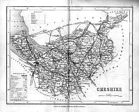
Cheshire County Map 1846

Drawn & Engraved by J. Archer especially for Thomas Dugdales; Curiosities of Great Britain England and Wales Delineated 1846.

Cheshire map 1846 Archer

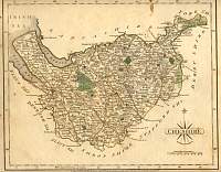
John Cary Map of Cheshire 1787

From John Cary's 1787 Atlas


Cheshire John Cary 1787

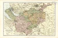
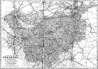
Phillip County Map of Cheshire 1890

George Phillip & Son


 Cheshire map 1890 George Phillip


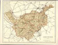
Bacon County Map of Cheshire 1904

Bacon's Popular Atlas of the British Isles


Cheshire map 1904 Bacon


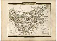
Cole County Map of Cheshire 1805

Superb early County map of Cheshire.


Cheshire map 1805 Cole


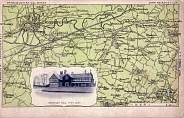
Postcard - Map of Warrington/Lymm


Postcard Map Warrington


Bacon Map from 1892 Kelly's Directory of Cheshire

cheshire map 1892 kelly's directory


Cheshire Parliamentary Map

County Atlas of Great Britain & Ireland by W. Hughes F.R.G.S.
Published by J.S. Virtue 1886.

Cheshire map 1886 Hughes


Copyright © 2003/2004/2005 Your Old Books & Maps