 |
|
|
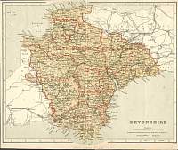
Devonshire 1846
Drawn & Engraved by J. Archer
especially for Thomas Dugdales; Curiosities of Great Britain
England and Wales Delineated 1846.
|
 |
|
|
Devonshire
North 1904
Bacon's Popular Atlas of the British Isles
|
 |
|
|
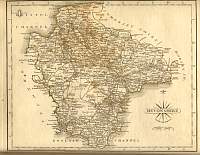
Devonshire
South 1904
Bacon's Popular Atlas of the British Isles
|
 |
|
|
Devon 1787 Cary
From John Cary's 1787 Atlas
|
 |
|
|
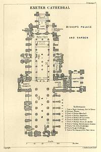
Exeter Cathedral Plan 1892
Guernsey map from South Devon & Cornwall Guide
1892. |
 |
|
|
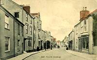
Chudleigh
Postcard |
 |
|
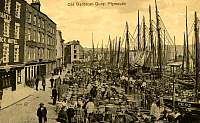
Plymouth Quay
Postcard |
 |
|
|
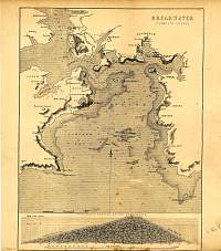
Plymouth Sound
1868
|
 |
|
|
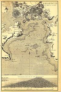
Plymouth Sound
1890
|
 |
|
|
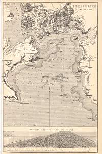
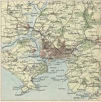
Plymouth Sound 1890
Mackenzie |
 |
|
|
Plymouth & Davenport 1896
Bartholomew
|
 |
|
|
Plymouth Sound
1890
|
 |
|
|
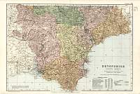
Devonshire
Parliamentary & County Atlas of Great Britain &
Ireland.
Maps by W. Hughes F.R.G.S.
Published by J.S. Virtue 1886. |
 |
|
