CUMBERLAND MAPS
|
|
|
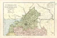
Cumberland
& Westmorland
North
1904
Bacon's
Popular Atlas of the British Isles
|
 |
|
|
Cumberland
& Westmorland
South
1904
Bacon's
Popular Atlas of the British Isles
|

|
|
|
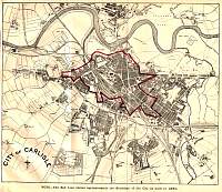
Cumberland 1929
(With Carlisle street plan)
Kelly's 1929 Directory of Cumberland
|

|
|
|
Buttermere
Etching
1893 Gazetteer of England and Wales published by
William Mackenzie.
|

|
|
|
Carlisle
1860
The map is in a book "Round Carlisle Cross" by
James Walter Brown
published by James Thurnam & Sons of Carlisle
1922.
|
|
|
|
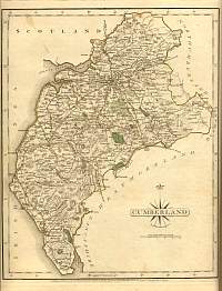
Cumberland
1787 John Cary
From John Cary's 1787 Atlas
|
|
|
|
Derwentwater
Etching
1893 Gazetteer of England and Wales published by
William Mackenzie.
|

|
|
|
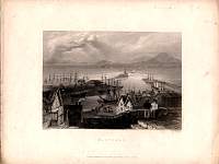
Maryport
Etching
1893 Gazetteer of England
and Wales published by William Mackenzie.
|
|
|
|
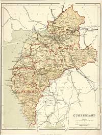
Cumberland
Parliamentary & County Atlas of
Great Britain & Ireland.
Maps by W. Hughes F.R.G.S.
Published by J.S. Virtue 1886.
|
|
|
