 |
|
|
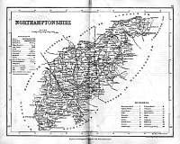
Northamptonshire 1846
Drawn & Engraved by J. Archer
especially for Thomas Dugdales; Curiosities of Great Britain
England and Wales Delineated 1846.
|
 |
|
|
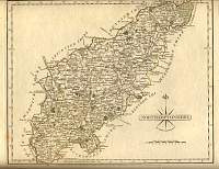
Northamptonshire 1787 Cary
From John Cary's 1787 Atlas
|
 |
|
|
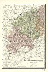
Northants 1890
Drawn by FS Weller FRGS and published in the Gazeteer of England
and Wales in the 1890's by William Mackenzie. |
 |
|
|
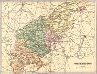
Northamptonshire 1904
North
Bacon's Popular Atlas of the British Isles |
 |
|
|
Northamptonshire 1904
South
Bacon's Popular Atlas of the British Isles
|
 |
|
|
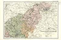
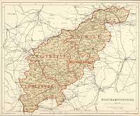
Northamptonshire
Parliamentary & County Atlas of Great Britain &
Ireland.
Maps by W. Hughes F.R.G.S.
Published by J.S. Virtue 1886. |
 |
|
