Old Maps of Worcestershire |
|
|
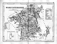
Worcestershire 1846
Drawn & Engraved by J. Archer
especially for Thomas Dugdales; Curiosities of Great Britain
England and Wales Delineated 1846.
|
 |
|
|
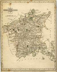
John Cary Worcestershire 1787
From John Cary's 1787 Atlas
|
 |
|
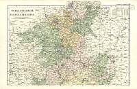
Bacon Map of North Worcestershire & Gloucestershire
North 1904 Bacon
|
 |
|
Bacon Map of South Worcestershire & Gloucestershire
South 1904 Bacon |
 |
|
|
Worcester Map - Owen 1736
|
 |
|
|
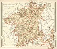
Worcestershire Parliamentary Map
Parliamentary & County Atlas of Great Britain &
Ireland.
Maps by W. Hughes F.R.G.S.
Published by J.S. Virtue 1886. |
 |
|
