 |
|
Page 1 - Page 2
|
|
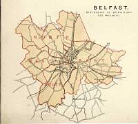
Belfast.
Parliamentary & County Atlas of Great
Britain & Ireland.
Maps by W. Hughes F.R.G.S.
Published by J.S. Virtue 1886. |
 |
|
|
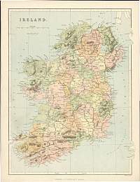
Ireland.
Parliamentary & County Atlas of Great
Britain & Ireland.
Maps by W. Hughes F.R.G.S.
Published by J.S. Virtue 1886. |
 |
|
|
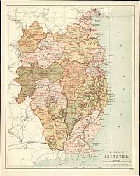
Leinster.
Parliamentary & County
Atlas of Great Britain & Ireland.
Maps by W. Hughes F.R.G.S.
Published by J.S. Virtue 1886. |
 |
|
|
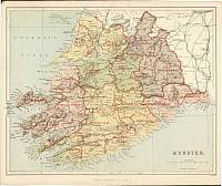
Munster.
Parliamentary & County Atlas of Great
Britain & Ireland.
Maps by W. Hughes F.R.G.S.
Published by J.S. Virtue 1886. |
 |
|
|
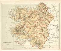
Connaught.
Parliamentary & County Atlas of Great
Britain & Ireland.
Maps by W. Hughes F.R.G.S.
Published by J.S. Virtue 1886. |
 |
|
|
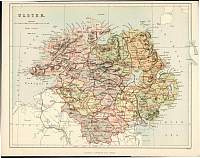
Ulster.
Parliamentary & County
Atlas of Great Britain & Ireland.
Maps by W. Hughes F.R.G.S.
Published by J.S. Virtue 1886. |
 |
|
|
Page 1 - Page 2 |
|
