 |
|
Page 1 - Page 2 -
Page 3 - Page
4
|
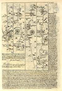
Strip map 1764.
Cheshire through Derbyshire to Derby via Buxton
and Braffinton (Brassington).
Britannia Depicta |
 |
|
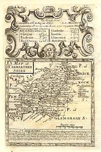
Strip map Carmarthenshire 1764.
Map of the county of Carmarthenshire.
Britannia Depicta |
 |
|
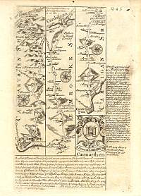
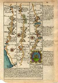
Strip map Carmarthenshire 1764.
Carmarthen, via Pembrokeshire and the town of Cardigan.
Britannia Depicta |
 |
|
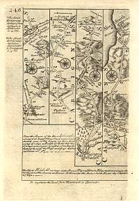
Strip map1764.
Cardiganshire to Aberiftwith (Aberystwyth).
Britannia Depicta |
 |
|
Strip map Carmarthenshire 1736.
Britannia Depicta
Route from Swanfey (Swansea, Glam) to Lacharne/Laughern (Laugharne,
Carmarthenshire, of Dylan Thomas the poet fame). |
 |
|
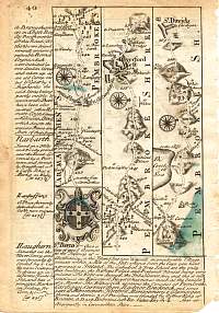
Strip map Carmarthenshire 1736.
Britannia Depicta
Route from Carmarthen, via Haverfordwest to St. David's, Pemb. |
 |
|
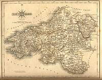
South Wales 1787 Cary
From John Cary's 1787 Atlas |
 |
|
|
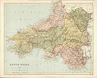
South
Wales
Parliamentary & County Atlas of Great Britain &
Ireland.
Maps by W. Hughes F.R.G.S.
Published by J.S. Virtue 1886. |
 |
|
|
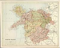
North
Wales
Parliamentary & County Atlas of Great Britain &
Ireland.
Maps by W. Hughes F.R.G.S.
Published by J.S. Virtue 1886. |
 |
|
|
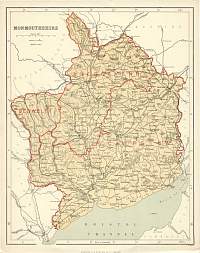
Monmouthshire
Parliamentary & County Atlas of Great Britain &
Ireland.
Maps by W. Hughes F.R.G.S.
Published by J.S. Virtue 1886. |
 |
|
|
Page 1 - Page 2 -
Page 3 - Page
4
|
|
