 |
|
|
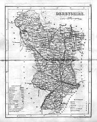
Derbyshire 1846
Scanned
image © David Ford
Drawn & Engraved by J. Archer
especially for Thomas Dugdales; Curiosities of Great Britain
England and Wales Delineated 1846.
|
 |
|
|
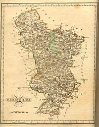
Derbyshire
Most probably a Bacon map.
Revision - Possibly before 1894 ?
|
 |
|
Derbyshire 1787 Cary
From John Cary's 1787 Atlas |
 |
|
|
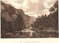
Dovedale
1893 Gazetteer of England and Wales published by William
Mackenzie.
|
 |
|
|
Derbyshire 1904
Bacon's Popular Atlas of the British Isles
|
 |
|
|
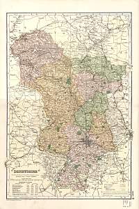
Derbyshire
Parliamentary & County Atlas of Great Britain &
Ireland.
Maps by W. Hughes F.R.G.S.
Published by J.S. Virtue 1886. |
 |
|
