 |
|
|
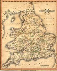
England & Wales
1846
Drawn & Engraved by J. Archer
especially for Thomas Dugdales; Curiosities of Great Britain
England and Wales Delineated 1846.
|
 |
|
|
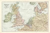
British Isles 1904
Bacon's Popular Atlas of the British Isles |
 |
|
British Isles 1830
Drawn & Engraved by Sidney Hall. |
 |
|
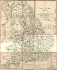
England & Wales 1809 John Cary
From John Cary's 1809 Atlas |
 |
|
Cary's 1828 Turnpike Rd Map
Cary's Reduction of his Large MAP of ENGLAND and WALES with part of SCOTLAND.
Containing the whole of the Turnpike Roads, the Principal Rivers & the course of
the different NAVIGABLE CANALS. |
 |
|
England & Wales 1904
Bacon's Popular Atlas of the British Isles |
 |
|
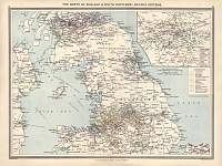
Railway Systems 1907
'The North of England & South Scotland: Railway Systems"
1907 George Phillip & Son. |
 |
|
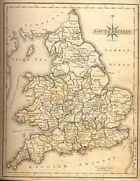
South Britain 1787 John Cary
From John Cary's 1787 Atlas |
 |
|
England & Wales Counties & Boroughs 1896
From Bartholomew's Royal Atlas |
 |
|
|
Railways - England & Wales..
Parliamentary & County Atlas of
Great Britain & Ireland.
Maps by W. Hughes F.R.G.S.
Published by J.S. Virtue 1886. |
 |
|
|
Physical - British Isles.
Parliamentary & County Atlas of
Great Britain & Ireland.
Maps by W. Hughes F.R.G.S.
Published by J.S. Virtue 1886. |
 |
|
|
Inland Navigation - England &
Wales..
Parliamentary & County Atlas of
Great Britain & Ireland.
Maps by W. Hughes F.R.G.S.
Published by J.S. Virtue 1886. |
 |
|
