Old Maps of Shropshire |
|
|
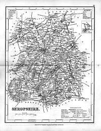
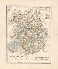
Shropshire 1846
Drawn & Engraved by J. Archer
especially for Thomas Dugdales; Curiosities of Great Britain
England and Wales Delineated 1846.
|
 |
|
|
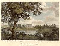
Dudmaston Hall, Shropshire
Dudmaston Hall, Shropshire. From The Copper Plate Magazine, 1792
Built by William or Francis Smith of Warwick, 1695. Belongs to the National Trust
|
 |
|
|
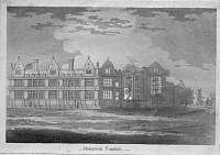
Moreton Corbet Castle
Moreton Corbet Castle, Shropshire. No date, no signature. Perhaps eighteenth
century ?
Although the castle dates back to c. 1200, what is shown in this engraving is
the Elizabethan range of c. 1579. Much of it still stands today.
|
 |
|
|
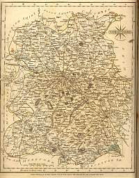
Shropshire 1787 Cary
From John Cary's 1787 Atlas
|
 |
|
|
Shropshire J.Archer 1800's.
Early 1800's Shropshire map - J.Archer.
|
 |
|
|
Shropshire 1890
George Phillip & Son
|
 |
|
|
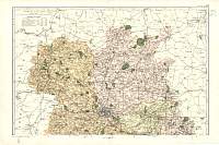
Shropshire 1904
North
Bacon's Popular Atlas of the British Isles
|
 |
|
|
Shropshire 1904
North
Bacon's Popular Atlas of the British Isles
|
 |
|
|
Shropshire
Parliamentary & County Atlas of Great Britain &
Ireland.
Maps by W. Hughes F.R.G.S.
Published by J.S. Virtue 1886. |
 |
|
