Old Maps of Hampshire |
|
Page
1 - Page 2
|
|
Hampshire 1846
Drawn & Engraved by J. Archer
especially for Thomas Dugdales; Curiosities of Great Britain
England and Wales Delineated 1846.
|
 |
|
|
Isle of Wight 1846
Drawn & Engraved by J. Archer
especially for Thomas Dugdales; Curiosities of Great Britain
England and Wales Delineated 1846.
|
 |
|
|
Hampshire - North 1904
Bacon's Popular Atlas of the British Isles
|
 |
|
|
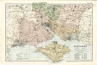
Hampshire - South 1904
Bacon's Popular Atlas of the British Isles
|
 |
|
|
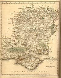
Hampshire 1787 Cary
From John Cary's 1787 Atlas |
 |
|
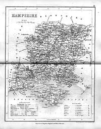
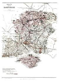
Hampshire 1859
Hampshire map from Kelly's 1859 Directory. |
 |
|
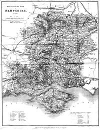
Hampshire 1915
Hampshire map from Kelly's 1915 Directory. |
 |
|
Hampshire 1935
Hampshire map from Kelly's 1935 Directory. |
 |
|
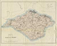
Isle
of Wight 1898
I.O.W. map from Kelly's 1898 Directory. |
 |
|
Isle
of Wight 1915
I.O.W. map from Kelly's 1915 Directory. |
 |
|
|
Page
1 - Page 2 |
|
