Old Maps of Staffordshire |
|
Page
1 - Page 2
|
|
Staffordshire 1846
Drawn & Engraved by J. Archer
especially for Thomas Dugdales; Curiosities of Great Britain
England and Wales Delineated 1846.
|
 |
|
|
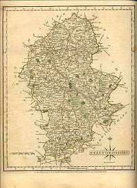
Staffordshire 1787 John Cary
From John Cary's 1787 Atlas
|
 |
|
|
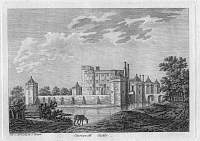
Caverswall Castle, Staffordshire
Engraving dated 11 April 1785 by S.Hooper
The walls and angle towers date from c. 1275. The house in the courtyard was
built c. 1615, designed by either John or Robert Smythson. It still stands
today.
|
 |
|
|
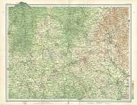
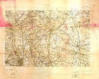
Crewe
& The Potteries Map 1903
J.G. Bartholomew
|
 |
|
|
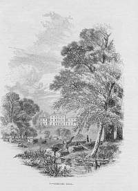
Etruria Hall, Staffordshire 1850
From 'The Land we Live in' 1850
Built for Josiah Wedgwood by Joseph Pickford, 1768. From his house, Wedgwood
could look down across the Trent and Mersey canal to his pottery works.
|
 |
|
|
Lichfield 1" O/S 1898
Printed 1902, O/S map of Lichfield
|
 |
|
|
Newcastle under Lyne Map 1868
|
 |
|
|
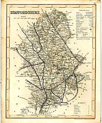
Staffordshire County Map 1838
J. Archer
|
 |
|
|
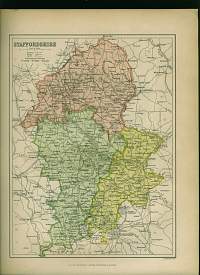
Staffordshire c. 1872
Showing the Parliamentary Divisions
J. Bartholomew. From Staffordshire & Warwickshire Past and Present.
|
 |
|
|
Staffordshire 1884 Bacon County Map
|
 |
|
|
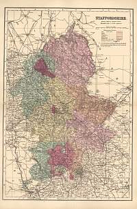
Bacon County Map of Staffordshire 1904
Bacon's Popular Atlas of the British Isles
|
 |
|
|
Page
1 - Page 2 |
|
