Old Maps of London & Middlesex |
|
Page
1 - Page 2
|
|
Westminster 1753
Westminster, London - scanned from a Gentleman's
Magazine - the North point points south.
|
 |
|
|
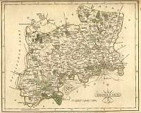
Middlesex 1846
Drawn & Engraved by J. Archer
especially for Thomas Dugdales; Curiosities of Great Britain
England and Wales Delineated 1846.
|
 |
|
|
Wyld's Plan of London 1854
|
 |
|
|
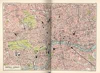
London 1920 Plan
Map from Black's Guide to London. |
 |
|
|
Middlesex 1787 Cary
From John Cary's 1787 Atlas
|
 |
|
|
Middlesex 1904
Bacon's Popular Atlas of the British Isles |
 |
|
|
Bishopgate St 1819 Etching
|
 |
|
|
Middlesex 1906
Map from the Middlesex Little Guide 1906. |
 |
|
Ice Fair on the Thames in
January 1739/40
A Frost Fair was held on the frozen Thames from Christmas 1739
till February 17. Souvenirs were printed on printing presses on
the ice. |
 |
|
|
Bacon Atlas 1883
London
North West Town Plan
|
 |
|
|
London 1904
Scanned from Bartholomew's Gazetteer of the British Isles 1904 |
 |
|
|
Page
1 - Page 2 |
|
