 |
|
|
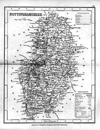
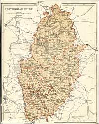
Nottinghamshire 1846
Drawn & Engraved by J. Archer
especially for Thomas Dugdales; Curiosities of Great Britain
England and Wales Delineated 1846.
|
 |
|
|
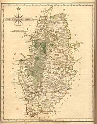
Nottinghamshire
1787 Cary
From John Cary's 1787 Atlas
|
 |
|
|
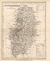
Nottinghamshire 1840 Archer
map |
 |
|
|
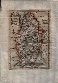
Nottinghamshire 1693
Hand tinted 1693 map of Nottinghamshire.
Published in 1720 by Robert Morden/Moreland.
The map is from a set of prints prepared by Robert Morden in
1693 which were apparently a bit of a cock-up on his part!
Morden was commissioned to produce a set of maps for Camden's
"Britannia" but he mis-understood the instructions and produced
this series of maps which were rejected for being too small for
the purpose. The maps weren't wasted and appeared in various
publications between 1701 & 1739.
|
 |
|
|
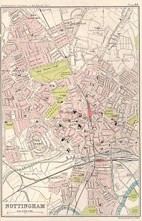
Nottingham 1904
Scanned from Bartholomew's Gazetteer of the British Isles 1904
|
 |
|
|
Nottingham 1904
Bacon's Popular Atlas of the British Isles
|
 |
|
|
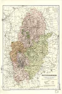
Nottinghamshire
Parliamentary & County Atlas of Great Britain &
Ireland.
Maps by W. Hughes F.R.G.S.
Published by J.S. Virtue 1886. |
 |
|
