Old Maps of Northumberland |
|
Page
1 - Page 2
|
|
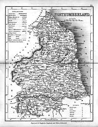
Northumberland County Map 1846
Drawn & Engraved by J. Archer
especially for Thomas Dugdales; Curiosities of Great Britain
England and Wales Delineated 1846.
|
 |
|
Northumberland 1787 County Map John Cary
From John Cary's 1787 Atlas
|
 |
|
Northumberland 1793 County Map John Cary
From John Cary's 1793 Atlas
|
 |
|
Northumberland 1885 County Map - Bacon
Bacon's Popular Atlas of the British Isles |
 |
|
|
Northumberland 1840 County Map
|
 |
|
|
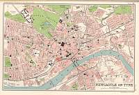
Newcastle Bartholomew Map 1904
Scanned from Bartholomew's Gazetteer of the British Isles 1904
|
 |
|
|
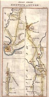
Berwick to Dunse (Duns) c. 18th C
Original strip map
|
 |
|
|
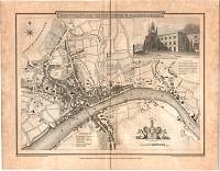
1788 - Newcastle upon Tyne & Gateshead
Engraved by R. Beilby
|
 |
|
|
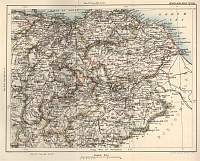
The Scottish Borders Map 1883
From Black's Guide to Scotland 1883
|
 |
|
|
Newcastle upon Tyne & Gateshead
1808
Cole & Roper |
 |
|
|
Page
1 - Page 2 |
|
