 |
|
|
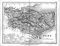
Kent 1846
Drawn & Engraved by J. Archer
especially for Thomas Dugdales; Curiosities of Great Britain
England and Wales Delineated 1846.
|
 |
|
|
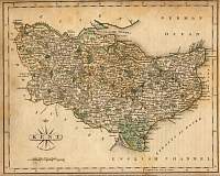
Kent 1787 Cary
From John Cary's 1787 Atlas |
 |
|
|
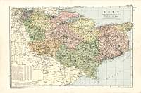
Kent 1904
Bacon's Popular Atlas of the British Isles |
 |
|
|
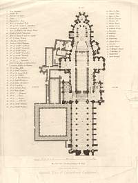
Canterbury Cathedral Plan
|
 |
|
|
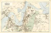
Bacon Atlas 1883
Chatham Town Plan |
 |
|
|
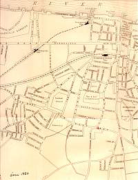
Gravesend 1922 Streetmap
(West)
Street map of Gravesend, circa 1922. From a 'History of
Gravesend' by F. A. Mansfield, published by the Gravesend and
Dartford Reporter (the local paper) in 1922. |
 |
|
|
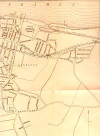
Gravesend 1922 Streetmap (East)
Street map of Gravesend, circa 1922. From a 'History of Gravesend' by F. A.
Mansfield, published by the Gravesend and Dartford Reporter (the local paper) in
1922. |
 |
|
|
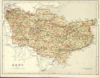
Kent
Parliamentary & County Atlas of Great Britain &
Ireland.
Maps by W. Hughes F.R.G.S.
Published by J.S. Virtue 1886. |
 |
|
